


Con Co Island – A Convergence of History and Nature
15-07-2025 15:25
1. Overview of Con Co Island
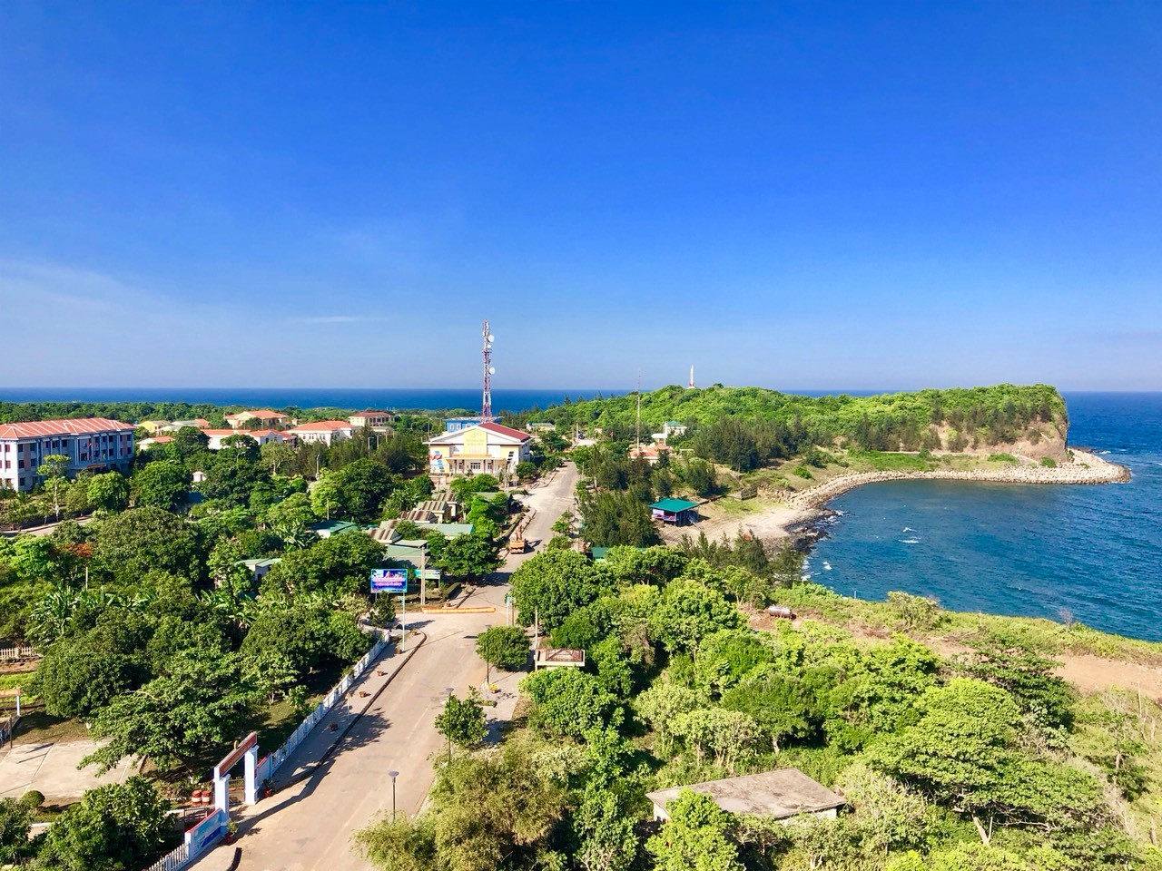
Con Co Island, an offshore district of Quang Tri Province, is located 15–17 nautical miles off the mainland to the east, positioned strategically at the southern gateway to the Gulf of Tonkin. Covering an area of approximately 2.3 km², the island not only represents Point A11 in Vietnam’s baseline for territorial sea delimitation, but also serves as a "living museum" bearing layered traces of historical heritage and unique natural values.
From prehistoric times—evidenced by archaeological discoveries at Ben Nghe and Ben Tranh—to the Cham era when it functioned as a maritime stopover for Southeast Asian trade, Con Co has witnessed cultural interactions over millennia. Under the Nguyen Dynasty, it served as a place of exile for prisoners and was documented on 19th-century international maps under names such as “Tigris Insula.” During the Vietnam War, Con Co became a symbol of resilience—a “warship that could not be sunk”—playing a key role in affirming Vietnam’s sovereignty through numerous heroic battles and fortified installations.
Today, with its preserved war relics, lush tropical forests, and vibrant marine ecosystems, Con Co is envisioned as a unique destination that harmonizes historical tourism, ecological exploration, and scientific research. Nevertheless, the sustainable development of the island hinges critically on the integrated preservation of its cultural and natural assets.
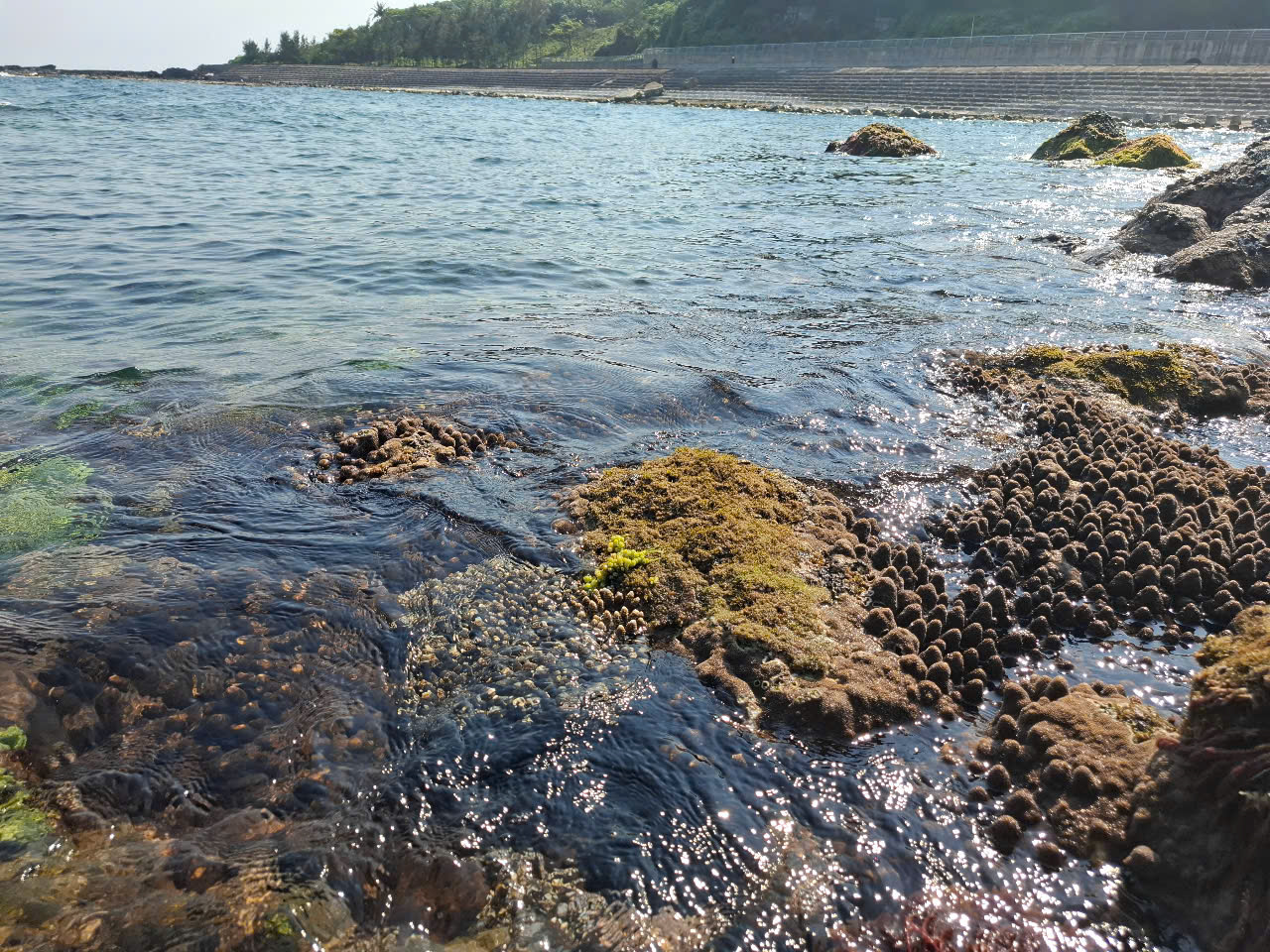
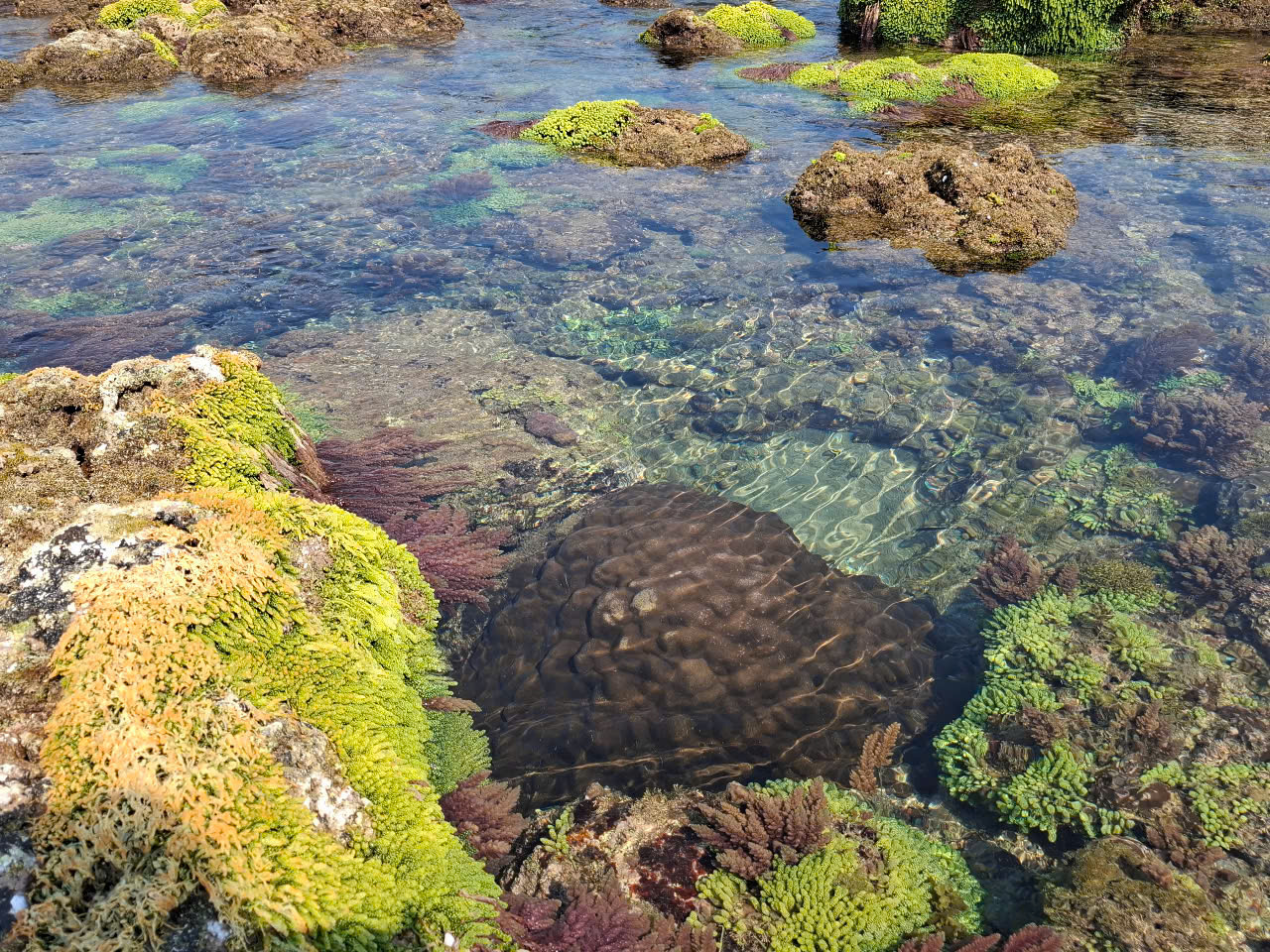 Rong biển trên đảo tạo môi trường sống cho các loài thủy sinh
2. Con Co Island Through Historical Periods
Prehistoric Period
Archaeological excavations at Ben Nghe and Ben Tranh in 1994 uncovered stone tools dating back to the Paleolithic era, indicating human presence on the island tens of thousands of years ago (Nguyen Khac Su, 1995).
Cham Pa Period (2nd–15th centuries)
From the early centuries CE, Con Co Island was inhabited by seafaring Cham Pa communities engaged in resource exploitation and maritime trade. Historical records indicate that Cham people used the island as a maritime stopover on routes from Central Vietnam to other Southeast Asian regions (Tran Ky Phuong, 2008). Although no definitive Cham Pa archaeological sites have yet been excavated on Con Co, comparative studies of late Sa Huynh and early Cham cultures in adjacent islands such as Ly Son and the Spratlys reveal characteristic Cham ceramics dating from the 2nd–5th centuries CE. These artifacts include dotted and corded patterns (Le Dinh Phung, 2015). Preliminary surveys at Ben Nghe on Con Co Island have uncovered ceramic shards that may be related to Cham material culture, though further study is needed for verification (Cung Phuot, 2025). The ancient Cham name “Thao Phu” suggests the island’s function as a maritime refuge (Tran Ky Phuong, 2008).
Nguyen Dynasty Period
During the Nguyen Dynasty, the island was used as a penal colony. A notable finding includes a human skeleton accompanied by iron shackles in an ancient well—evidence of the island’s punitive function (Nguyen Duc Tan, 2024). Maritime charts of the 19th century, such as the “An Nam Đại Quốc Họa Đồ” (1838) and John Crawfurd’s maps (1820–1829), referred to the island using various names including Hon Co, Tigris Insula, and “Tiger Island.”
Vietnam War Period
Following the Geneva Accords (1954), Con Co gained strategic significance due to its proximity to the 17th parallel. In 1959, a Vietnamese artillery platoon led by Lieutenant Duong Duc Thien raised the national flag on the island, reaffirming sovereignty. From 1964 to 1968, Con Co endured more than 13,000 bombs, tens of thousands of rockets, and over 4,000 artillery shells from U.S. forces. Local defenders engaged in 841 battles, downed 48 aircraft, and sank 17 warships—earning the island the title “the unsinkable warship.” Key wartime relics include:
-
A 20 km trench and tunnel system connecting combat positions
-
Dozens of bunkers and coastal fortifications
-
Historic sites such as Hill 37, Hill 63, Ha Dong, Hanoi, Hai Phong, and Thai Van A Observation Post
-
A traditional museum housing wartime artifacts and photos
Con Co was twice awarded the title Hero of the People’s Armed Forces, along with numerous medals. President Ho Chi Minh sent three commendation letters, including a celebrated couplet:
“Con Co blossoms with victorious flowers –
Smashing American invaders into dust.”
Post-war Period
After 1976, Con Co was converted from a military to a civilian island (under Decree 174/2004/ND-CP). Historical relics have since been preserved alongside the development of historical tourism. Key monuments include:
-
Hill 37 Memorial, commemorating fallen soldiers
-
Traditional museum exhibiting artifacts and historical documents
-
National flagpole, 38.8 meters tall, symbolizing national sovereignty
-
Con Co lighthouse, serving both navigation and tourism purposes
Infrastructure development, includes fishing ports, anti-erosion embankments, and educational facilities. Historical tourism now attracts approximately 9,500–10,000 visitors annually.
3. Natural Values of Con Co Island
Geological Heritage
Formed by volcanic activity around 40,000 years ago, Con Co features basalt terraces, lava flows, cylindrical basalt columns, and rugged cliffs up to 20 meters in height (Nguyen Van Cuong, 2015). The Neogene tuff cross-section represents a valuable geological profile (Tran Dinh Lan, 2019). Coral, shell, and sand-derived beaches, coupled with seawater clarity reaching 15–20 meters, create landscapes of scientific and ecotourism potential (Department of Natural Resources and Environment, Quang Tri, 2021).
Terrestrial Ecosystem
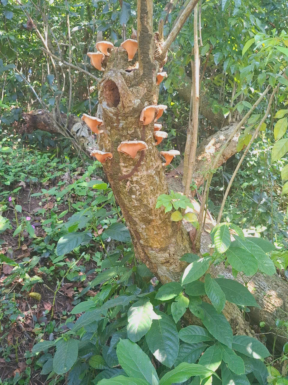
Covering about 160 hectares—roughly 70% of the island’s area—Con Co’s tropical three-layer forest plays a crucial role in regulating climate, buffering wind, and preventing erosion (Con Co Marine Protected Area Management Board, 2022). The island hosts 136 plant species across 53 families, including native trees such as Barringtonia asiatica, Heliotropium foertherianum, and Pandanus tectorius, as well as medicinal species like Gynostemma pentaphyllum (Nguyen Thi Hong, 2020). The centuries-old square-fruited barringtonia is a symbol of resilience in harsh coastal conditions. The island also shelters the endemic and threatened land crab Gecarcinus lalandii, now critically endangered due to overexploitation (IUCN, 2023).
Marine Ecosystem
The surrounding sea, part of the Con Ho fishing ground (approx. 9,000 km²), includes the 5,300-hectare Con Co Marine Protected Area (MARD, 2017). It hosts 267 fish species from 120 genera and 69 families, with an estimated annual biomass of 60,000 tons (Vietnam Institute of Marine Research, 2019). Diverse species of crustaceans (lobster, crab), mollusks (e.g. giant clam Tridacna gigas), and commercial fish (mackerel, tuna) are abundant (DARD Quang Tri, 2021). The coral reef system comprises 113 species from 44 genera and 15 families, with average coral cover between 30–40% (Nguyen Van Quan, 2020). Seagrass beds—mainly Halodule uninervis and Thalassia hemprichii—stabilize sediments and store CO₂ (Tran Thi Thanh, 2022). However, declining populations of giant clams and land crabs due to overharvesting necessitate urgent conservation (WWF Vietnam, 2021).
4. Strategies for the Sustainable Preservation and Development of Con Co Island
To effectively preserve and enhance Con Co Island’s historical and natural values, a comprehensive and interdisciplinary approach is required—one that integrates heritage conservation, sustainable livelihoods, community engagement, and international cooperation.
The island's development should follow a zoning model that differentiates core ecological reserves (coral reefs, seagrass beds, primary forests), cultural heritage sites (to be restored and protected), and regulated eco-tourism zones. This mirrors successful models such as Jeju Island (South Korea), where UNESCO-recognized geosites coexist with managed tourism.
Regarding war relics and historical landmarks, preservation efforts should move beyond static display toward immersive education. Technologies such as 3D reconstruction, virtual reality (VR), and augmented reality (AR) can revitalize the visitor experience by recreating battle scenes and historical life. The Corregidor Island model in the Philippines, with its living history tours and multimedia exhibitions, offers a compelling example.
Protection of the island’s ecosystems should be pursued via community-based co-management. Local residents must be empowered as stewards of natural resources while benefiting from green livelihoods, including native medicinal plant cultivation, apiculture, and eco-tourism services. Apo Island in the Philippines demonstrates the efficacy of this model in sustaining both conservation and income generation.
Infrastructure should adhere to ecological and smart development principles. Construction must prioritize local, sustainable materials while integrating renewable energy sources such as solar and wind. Waste management and wastewater treatment systems should be upgraded to prevent marine pollution.
Human capital development is equally vital. Training programs for local tour guides—equipped with knowledge of history, ecology, and local culture—should be implemented to transform residents into ambassadors of heritage.
Finally, international collaboration is key. Engagement with organizations like UNESCO, IUCN, and WWF can provide technical and financial support, while a dedicated Con Co Island Research Center could serve as a hub for interdisciplinary studies in archaeology, biodiversity, and climate change.
In sum, the sustainable future of Con Co lies in transforming its unique identity into a living model of integrated conservation and responsible development—where heritage, nature, and community thrive in symbiosis.
5. Conclusion
Con Co Island is more than a geographic landmark on Vietnam’s administrative map; it is a dynamic space where history, ecology, and cultural memory converge. From prehistoric settlements and Cham maritime legacies to wartime fortresses and present-day green landscapes, the island stands as a resilient symbol of national identity and regeneration.
Yet, these invaluable attributes also expose Con Co to modern challenges: tourism pressure, climate change, biodiversity loss, and the commodification of heritage. Preservation here must go beyond mere conservation; it must become an active, creative process that transforms heritage into the foundation for sustainable development.
This requires a unified, multi-sectoral strategy involving communities, scientists, enterprises, and international partners. Con Co should not be perceived as a remote outpost, but as a potential model for how conservation and development can harmoniously co-exist—producing timeless value.
To safeguard Con Co is to preserve a vital part of Vietnam’s maritime identity, a soft marker of sovereignty, and an irreplaceable ecological–cultural treasure. It is also a message to future generations: history is not confined to museums, but lives on—every day—between sea and sky, on this small yet mighty island.
References
1. Nguyễn Khắc Sử (1995). Khảo cổ học Việt Nam: Thời tiền sử. Nhà xuất bản Khoa học Xã hội, Hà Nội, trang 245-250.
2. Trần Kỳ Phương (2008). Văn hóa Chăm Pa: Giao lưu hàng hải và thương mại. Nhà xuất bản Thế Giới, TP. Hồ Chí Minh, trang 112-118.
3. Lê Đình Phụng (2015). Khảo cổ học biển đảo Việt Nam: Tiềm năng và triển vọng. Nhà xuất bản Khoa học Xã hội, Hà Nội, trang 85-90.
4. Nguyễn Văn Cường. (2015). Đặc điểm địa chất và tiềm năng du lịch đảo Cồn Cỏ. Tạp chí Khoa học Địa chất, 12(3), 45-52.
5. Trần Đình Lân. (2019). Di sản địa chất núi lửa Cồn Cỏ. Hội Địa chất Việt Nam.
6. Sở Tài nguyên và Môi trường Quảng Trị. (2021). Báo cáo đánh giá chất lượng nước biển Cồn Cỏ.
7. Ban Quản lý Khu bảo tồn biển Cồn Cỏ. (2022). Báo cáo hiện trạng hệ sinh thái rừng Cồn Cỏ.
8. Nguyễn Thị Hồng. (2020). Đa dạng thực vật đảo Cồn Cỏ. Tạp chí Sinh học Việt Nam, 18(2), 33-40.
9. IUCN. (2023). Danh sách đỏ các loài bị đe dọa: Cua đá Cồn Cỏ. Truy cập tại: www.iucnredlist.org.
10. Bộ Nông nghiệp và Phát triển nông thôn. (2017). Quy hoạch ngư trường Con Hổ.
11. Viện Nghiên cứu Hải sản. (2019). Đa dạng sinh học biển Cồn Cỏ. Báo cáo khoa học.
12. Sở Nông nghiệp và Phát triển nông thôn Quảng Trị. (2021). Báo cáo trữ lượng thủy sản vùng biển Cồn Cỏ.
13. Nguyễn Văn Quân. (2020). Hiện trạng rạn san hô Cồn Cỏ. Tạp chí Môi trường Biển, 15(4), 22-29.
14. Trần Thị Thanh. (2022). Vai trò thảm cỏ biển trong hệ sinh thái Cồn Cỏ. Hội nghị Khoa học Biển Việt Nam.
15. WWF Việt Nam. (2021). Báo cáo bảo tồn các loài biển nguy cấp tại Cồn Cỏ.
16. Nguyễn Đức Tân (2024). Cồn Cỏ: Hành trình phát triển du lịch lịch sử. Báo Tiền Phong, truy cập tại: https://tienphong.vn, ngày 13/10/2024.
17. Cung Phượt (2025). Kinh nghiệm du lịch Cồn Cỏ, Quảng Trị (Cập nhật 1/2025). Truy cập tại: https://cungphuot.info, ngày 13/01/2025.
18. Cổng thông tin huyện Cồn Cỏ (2024). Lịch sử và phát triển huyện đảo Cồn Cỏ. Truy cập tại: http://conco.quangtri.gov.vn, ngày 16/10/2024.
19. Tạp chí Quốc phòng toàn dân (2024). Cồn Cỏ: Chiến hạm không thể chìm. Truy cập tại: http://tapchiqptd.vn, ngày 15/04/2024.
Thế giới động vật hang động Phong Nha – Kẻ Bàng
Khám phá thế giới động vật hang động Phong Nha – Kẻ Bàng: cá mù Hang Va, tôm càng Phong Nha, bọ cạp Thiên Đường, ốc nón Sơn Đoòng và các loài mới cho khoa học trong karst.
Đặc điểm và giá trị toàn cầu của hệ thống hang động karst Phong Nha – Kẻ Bàng
Phong Nha - Kẻ Bàng có tuổi karst cổ, cấu trúc nhiều hệ thống hang lớn, phân tầng và hình thái đa dạng của Phong Nha – Kẻ Bàng, đối chiếu với các di sản hang động tiêu biểu thế giới.
Karst Cave Formation: The Case of the Phong Nha–Ke Bang Limestone Massif
This article explores the karst cave formation process in the Phong Nha – Ke Bang limestone massif, highlighting geological stages shaped by water, tectonics, and tropical climate over millions of years.
Hệ Thống Cảnh Báo Sớm: Lá Chắn Mềm Trước Thiên Tai
Trong bối cảnh khí hậu toàn cầu ngày càng nóng lên và các hiện tượng thời tiết cực đoan gia tăng, thiên tai ở Việt Nam đang gây thiệt hại nặng nề về người và tài sản. Bài viết phân tích vai trò của hệ thống cảnh báo sớm thiên tai như một “lá chắn mềm” giúp giảm nhẹ rủi ro