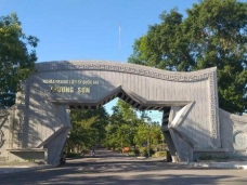
Historical Sites along the Hồ Chí Minh Trail through Bình – Trị – Thiên
10-07-2025 16:12
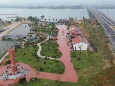
Location
Highlight Image


1. Introduction
I vividly recall one morning when my uncle invited me for coffee and spoke about a manuscript he was editing — Uncle Võ Văn Ấp, known by his revolutionary alias Hùng Sơn, was the co-editor of the book "The Hồ Chí Minh Trail through Bình – Trị – Thiên", published by the People’s Army Publishing House in 1992. He was not merely a historian but a living witness — someone who lived, fought, recorded and preserved memories that would otherwise fade into oblivion.
The Hồ Chí Minh Trail, also known as the Trường Sơn Trail, is more than a logistical route — it is a legendary symbol in Vietnam’s resistance war against the United States. The stretch that runs through Quảng Bình, Quảng Trị, and Thừa Thiên Huế — formerly unified under the name Bình Trị Thiên — holds strategic and emotional weight. It served as a pivotal hinge, a vital supply hub, and one of the fiercest battlegrounds bombarded by enemy air raids.
This route bears not only military significance but also immortalises the silent sacrifices of tens of thousands of soldiers, logistics workers, youth volunteers, and local villagers. Each footprint, each tyre track, and every jungle hut echoes with war memories and unyielding resilience. Although the war ended five decades ago, the 28 historical sites spanning from Quảng Bình to A Lưới (Huế) remain an “open-air library” of national history. Each step along this path is not merely an exploration but an act of remembrance — for there were those who walked, never to return, so that the nation might walk in peace.

2. Historical Formation
Following the 1954 Geneva Accords, Vietnam was provisionally divided at the 17th parallel, with a commitment to conduct general elections in 1956 to reunify the country. However, the U.S.-backed Ngô Đình Diệm regime outright rejected this election and brutally suppressed revolutionary forces, effectively sabotaging the peace process.
In response, the 15th Central Committee Conference in January 1959, chaired by President Hồ Chí Minh, concluded that the liberation of the South would require a combination of political and armed struggle. Consequently, the Politburo and Central Military Commission authorised the construction of a strategic transport route through the treacherous Trường Sơn mountains to support the southern revolution.
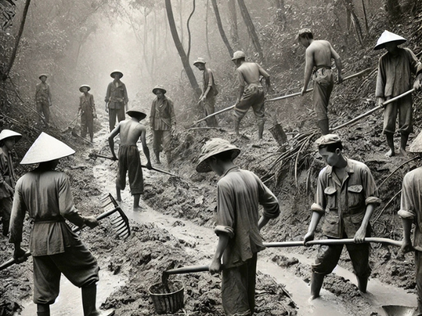
On 19 May 1959, Group 559 was formally established with the mission of opening the trail, transporting troops, weapons, and supplies, thereby connecting rear bases in the North with frontlines in the South. This trail became not just a supply line but a battlefield, a logistical stronghold, and a powerful symbol of resistance and Indochinese solidarity.
From their first footsteps at Khe Hó, Ba Rền, Lâm Hóa, Khe Ve, and Cha Lo, the pioneers, including thousands of youth volunteers, carved narrow jungle trails — lifelines that endured relentless bombing from 1965–1972. The Bình Trị Thiên section became a primary conduit, traversing deep forests, rugged mountains, and torrential rivers.
According to the book "The Hồ Chí Minh Trail through Bình – Trị – Thiên" by Hùng Sơn and Lê Khai (1992), “In 1968 alone, the Cha Lo–Đakrông segment endured over 150 bombing raids per week, yet convoys and foot soldiers still advanced, transported supplies, and evacuated the wounded.” [1]
3. Historical Sites
The Hồ Chí Minh Trail through Bình – Trị – Thiên comprises a dense network of monuments reflecting the construction, combat, logistics and sacrifices on this legendary supply route.
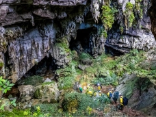
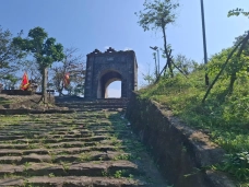
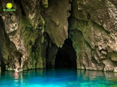
In Quảng Bình, 18 major sites are linked to key trunk roads such as Route 20 Quyết Thắng, Route 10, and Route 16. Notable sites include: Khe Rinh Ford, Gianh Ferry, Đá Đẽo Pass, Hóa Tiến Cave (headquarters of Command 559), Xuân Sơn Ferry, Km4 Communication Cave, NH Arsenal Cave, Ba Thang Slope, Long Đại Ferry, Km0 of Route 10, Ka Tang Bridge, Thạch Bàn Junction, Làng Ho, Command HQ at Hiền Ninh, the Eight Youth Martyrs Cave, ATP Focal Zone, Động Mã, and Mụ Giạ Border Gate — origin of the legendary fuel pipeline to Laos.
In Quảng Trị, 6 notable sites mark this ferocious battlefield and logistical centre: Khe Hó (first base of Battalion 301), Bến Tắt Suspension Bridge, Trường Sơn National Cemetery, Command HQ (1974–75), Đakrông Bridge and Đông Hà Port — the critical logistics hub connecting North to Trị Thiên battlefield.
Thừa Thiên Huế hosts 4 key sites, primarily in the mountainous A Lưới district: Km0 of Route B.45A, Km0 of Route B71, the Command Bunker Complex of Station 42, and Con Mèo Slope — all associated with strategic highlands and fierce engagements.
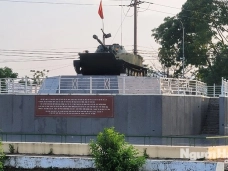
Altogether, the trail segment through Bình Trị Thiên includes at least 28 officially recognised sites — living relics of wartime ingenuity, courage and sacrifice. These landmarks serve both as sacred memory and invaluable resources for historical tourism and environmental exploration.
The route also bore witness to landmark battles. The 1971 Campaign Route 9 – Southern Laos marked a decisive offensive by the Vietnamese People's Army against US-South Vietnamese logistics bases in Sê Pôn – Lao Bảo. Key trails like Route 9, Trạ Ang Ford, and Đá Đẽo Pass were heavily bombarded in an attempt to sever reinforcements. At Trạ Ang alone, March 1971 saw hundreds of daily airstrikes. [1]
The silent but crucial role of logistical volunteers, youth brigades, and especially ethnic communities like the Vân Kiều and Tà Ôi cannot be overstated. They carried rice, hauled ammunition, led troops, built shelters, and sheltered soldiers. Villages such as Hướng Lập, Hướng Linh, A Roàng, and A Lưới were people’s logistics bases. Many gave their lives, nameless, faceless — but eternally remembered.

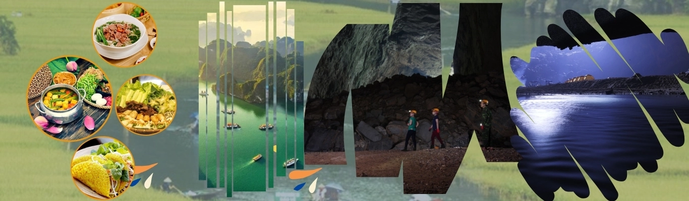
4. The Trường Sơn Trail Today
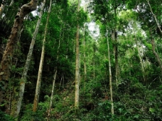
Post-war, the Trường Sơn Trail was modernised into the Hồ Chí Minh National Highway. The Bình Trị Thiên section now weaves through reborn forests, with historical-ecological destinations like Route 20 Quyết Thắng, the Eight Youth Martyrs Cave, Đá Đẽo Pass, Đakrông Bridge, and Trường Sơn Cemetery [3].
Branch routes to strategic border gates such as Cha Lo (Quảng Bình), Cà Roòng, Lao Bảo, and La Lay (Quảng Trị) now boost Vietnam–Laos trade and poverty reduction efforts in these remote highlands.
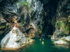
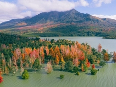
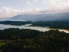
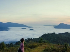
Along this route lie key ecological reserves and national parks — Động Châu – Khe Nước Trong, Bắc Hướng Hóa, Đakrông (Quảng Trị), and Bạch Mã National Park (Huế). These are biodiversity hotspots and ecotourism hubs, ideal for conservation and environmental education [2].
Cool-climate areas like Khe Sanh, Hướng Phùng, and Hướng Linh have developed organic agriculture: coffee, pepper, and macadamia [4]. In Nam Đông and A Lưới (Huế), favourable soil and weather support sustainable farming and medicinal herb cultivation.
Today, the Hồ Chí Minh Trail is no longer solely a historic relic — it is a development corridor connecting agriculture, tourism, trade, and conservation. It proves that while war ends, the roads of peace endure.

5. Conclusion
On the war map, the Hồ Chí Minh Trail through Bình Trị Thiên was a crimson artery hidden within Trường Sơn’s vastness. But in the hearts of Vietnamese people, it is the road of humanity, patriotism, and unwavering faith in victory.
Today, standing amid lush jungles once scorched by bombs, we still hear echoes of wartime convoys, silent footsteps, and revolutionary songs whispered through the trees.
That path — once shouldering the fate of a nation — is now a journey through memory, gratitude, and green futures. As one Trường Sơn soldier once wrote: “We walked, not to return — but so our children could grow in peace.”
This segment of the Hồ Chí Minh Trail, now recognised as a Special National Monument, deserves a comprehensive preservation plan. It should become a trans-provincial historical-ecological tourism route connecting Quảng Bình, Quảng Trị, and Thừa Thiên Huế — nurturing both revolutionary legacy and sustainable borderland development.
References:
[1] H. Sơn & L. Khai, The Hồ Chí Minh Trail through Bình Trị Thiên, People's Army Publishing House, 1992.
[2] WWF Vietnam, Biodiversity of the Trường Sơn Range and Green Conservation Solutions, 2021.
[3] Nhân Dân Newspaper, Developing the East–West Corridor with Strategic Border Gateways in Central Vietnam, 2023.
[4] Ministry of Agriculture and Rural Development, Report on Organic Agriculture in Western Quảng Trị, 2020.