Son Tra Peninsula – A Sanctuary of Nature and Culture
31-07-2025 16:13
Main contents
Location
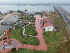
Highlight Image
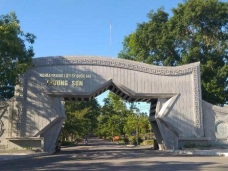
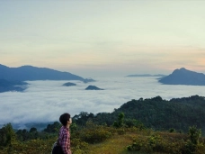
Arrival at Son Tra
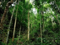
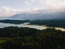
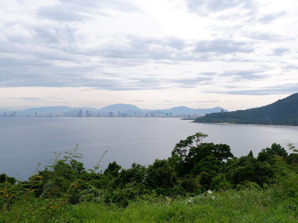
Just 10 kilometers northeast of Da Nang’s city center, Son Tra Peninsula rises like a deep-green forested carpet unfurled beside the sea – the only primeval forest nestled in the heart of a Vietnamese city. The moment I set foot at the foot of the mountain, I could feel the cool, pure air breathing from the dense canopy above. It is no wonder that Son Tra is called the “green lung” of Da Nang – a natural shield that moderates the city’s climate and supplies it with life-giving oxygen.
For centuries, Son Tra has been etched into ancient records. In Phu Bien Tap Luc, scholar Le Quy Don noted that Son Tra Mountain (locally called Hon Nghe) was “said to hold a gem that shone upon the sea each night.” Local tales spoke of fairies descending to bathe and play, earning it the name “Tien Sa” – the Mountain of Landing Fairies. Even King Le Thanh Tong, on his 15th-century campaign into the land of Champa, stopped at the harbor beneath Son Tra, composing poetry by the shore. This coastline, it seems, was already a thriving international trading port 600 years ago.
Son Tra is not only blessed with breathtaking scenery, but it also cradles layers of history and legend. Intrigued and eager, I continued my journey, ready to uncover the extraordinary natural and cultural treasures hidden on this one‑of‑a‑kind peninsula.
Exceptional Natural Heritage
Son Tra Peninsula boasts a rare and pristine tropical rainforest ecosystem, where plant and animal life flourish in extraordinary diversity. Research shows that its flora alone accounts for 14% of Vietnam’s total plant species, while migratory birds passing through here make up over 13% of the country’s recorded migratory species. Located at the climatic crossroads between North and South Vietnam, Son Tra’s forests are home to a unique blend of northern and southern species — from emblematic hardwoods to tropical lowland plants — coexisting in what is truly a “giant natural park” within a vibrant coastal city.
Across the peninsula, some 20 seasonal streams wind down from the mountains, with Da Stream and Heo Stream providing fresh water to surrounding communities. Generously, Son Tra has gifted Da Nang not only with clean water but also with the pure, oxygen-rich air that drapes over the city. Its 4,400 hectares are mostly cloaked in dense evergreen tropical forest, though human activity has reduced its coverage (by 1989, only about 67% remained forest, according to GreenViet).
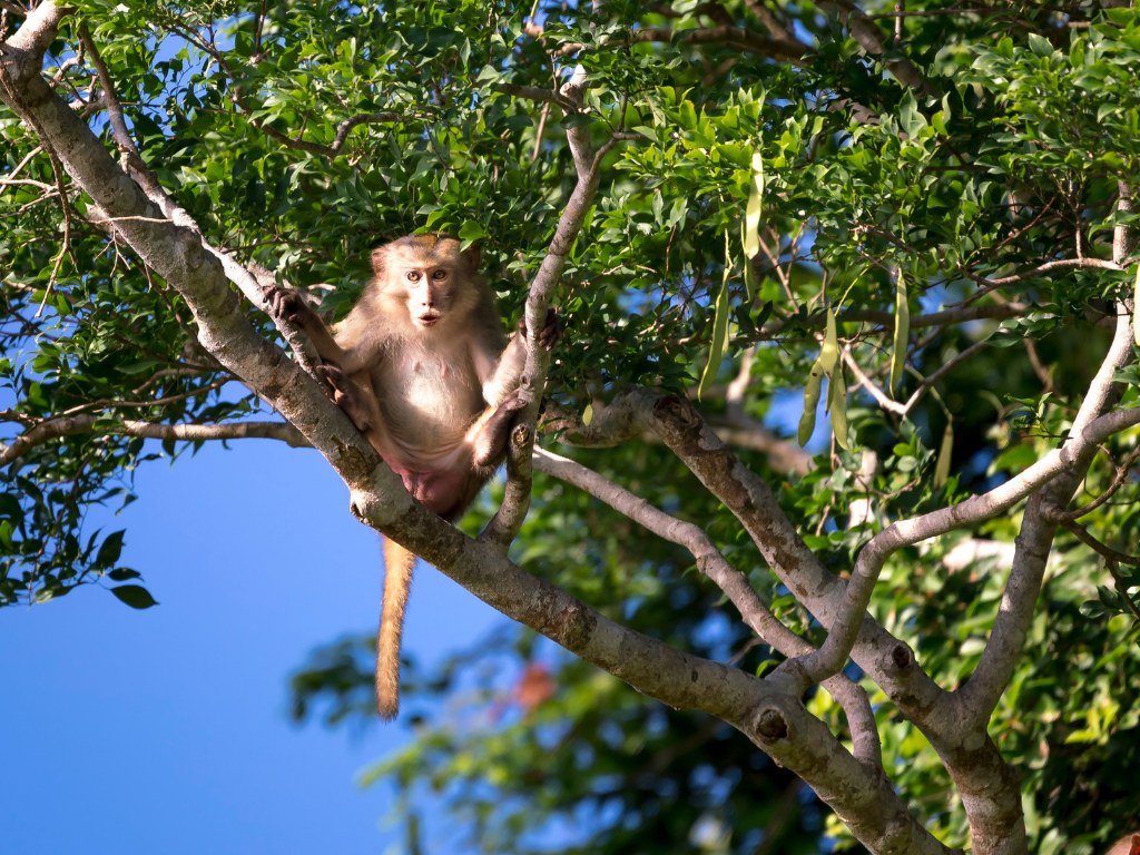
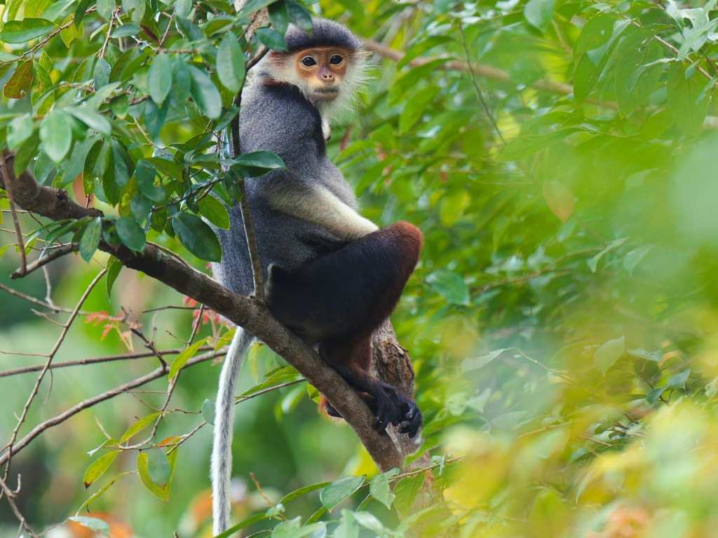
Among its most celebrated inhabitants is the red-shanked douc langur, an Indochinese primate ranked Critically Endangered (CR) in Vietnam’s Red Data Book and by the IUCN. Son Tra is home to one of the largest wild populations on Earth: surveys by GreenViet estimated about 1,300 individuals in 2017, and recent counts show over 2,000 today — representing a significant share of the global wild population.
Beyond the doucs, Son Tra shelters a wealth of rare and protected species. Its nature reserve records 1,679 species of plants and animals, including 1,010 vascular plant species and 366 vertebrate species. Of these, there are 42 mammals, 162 bird species, 55 reptiles, 22 amphibians, and 231 insect species. Notably, 68 species (10 plants and 58 animals) are listed as endangered, rare, or endemic under the Vietnam Red Data Book, the IUCN Red List, or CITES. Incredibly, within less than 0.014% of Vietnam’s total area, Son Tra holds nearly 9.4% of the country’s higher plant species — including 22 rare plants. Along the trails, giant banyans drop tangled roots into the soil, their vast canopies shading whole corners of the forest.
Geologically, Son Tra is equally remarkable. According to the 1:50,000-scale Geological Map of Da Nang – Hoi An (1986) and studies by the Institute of Geological Sciences and Minerals (2010), the peninsula is part of the ancient Kon Tum uplift, its northeastern flank abutting the Han River depression. The terrain is dominated by granitic-biotite intrusions dating back 260–250 million years to the Late Permian period.
Some foothill and coastal areas bear Quaternary sediments — sand, pebbles, and clay — evidence of past marine incursions and strong erosion during the last ice age. Distinctive “tor” rock formations and weathered granite boulders, shaped like mushrooms or rounded domes, mark the slopes, formed through the combined effects of physical (temperature shifts) and chemical weathering (humidity, acid rain). Coastal cliffs, such as “Da Ong Nghe” and “Elephant Head Rock,” bear the scars of ancient marine erosion and tectonic shifts.
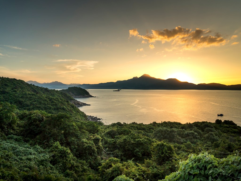
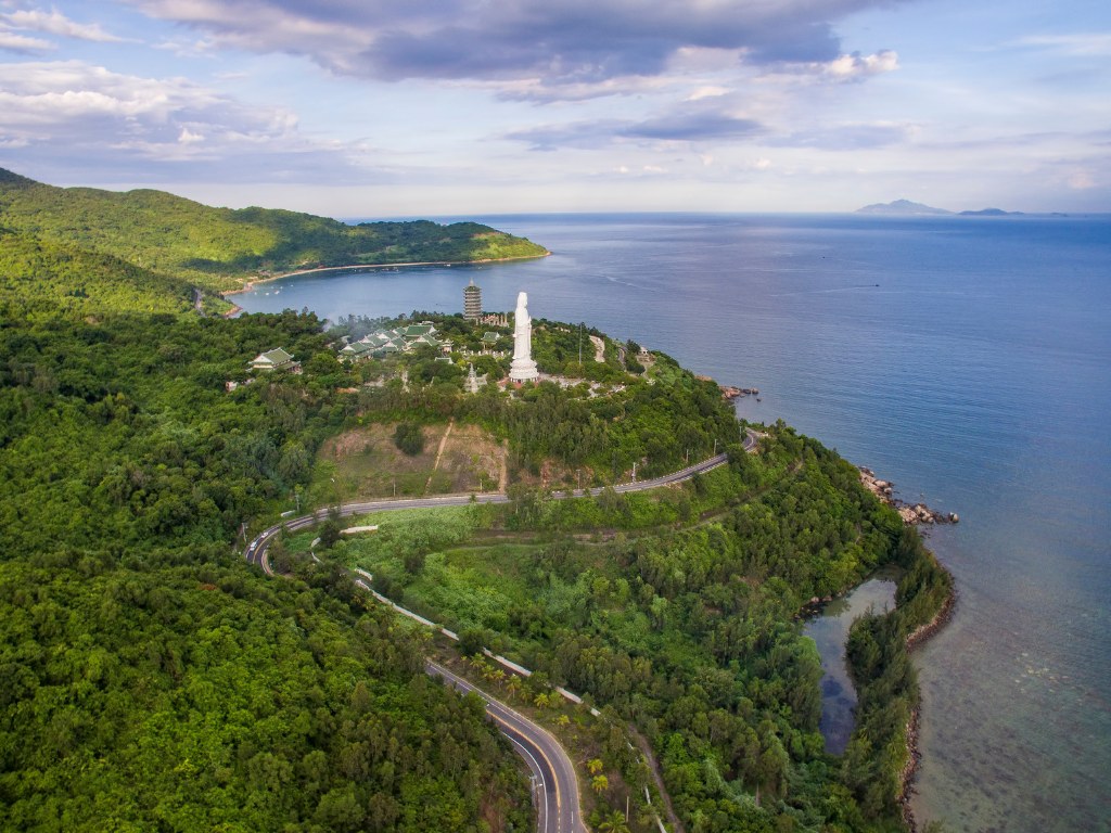
Uniquely, as noted by Le Trong Hung et al. (2016), Son Tra is the only remaining high mountain range directly by the sea in Central Vietnam. Its tallest point, Ban Co Peak, rises to 693 meters. Three sides meet the sea, creating a special “mountains-meet-ocean” landscape — an “inland ecological island” in the eyes of many scientists. Sea erosion along the cliffs has carved caves, notches, and abrasion platforms, enriching the coastal-marine ecosystem.
Satellite imagery and topographic maps suggest that Son Tra was once an offshore island. At the end of the Pleistocene (about 10,000–12,000 years ago), post-glacial sea level rise created the modern shoreline. Sediment from the Han and Cu De rivers gradually formed a sandy spit that connected Son Tra to the mainland — a rare coastal accretion phenomenon in Central Vietnam (Nguyen Van Cu & Nguyen Huu Quy, 2000).
This fusion of steep mountain slopes, sheer sea cliffs, diverse bedrock (granite, shale, Quaternary sediments), and the geological evolution from isolated island to peninsula has made Son Tra not only a “geological gem” but also a cradle for the extraordinary biodiversity we see today. Thanks to its ancient granite, which drains quickly, Son Tra’s streams run clear and fast, feeding lush understory vegetation and supporting rocky intertidal zones where unique coastal species — from rock crabs to shallow-water corals — thrive.
Cultural and Historical Significance
The highest point of Son Tra Peninsula is Ban Co Peak, rising nearly 700 meters above sea level. From here, one can command sweeping views over all directions — including the strategic sea gateway below. This vantage point has given Son Tra immense military importance throughout history.
During the Nguyen Dynasty, the mountains and Trà Son Bay were regarded as a “critical stronghold of the coastline” requiring strict control. Emperor Minh Mang even issued decrees forbidding foreign vessels from anchoring long in the bay and prohibiting foreigners from climbing the mountain or setting up trading posts — all to safeguard Vietnam’s maritime borders. The court constructed a formidable defense system here, considered the most secure among all of Vietnam’s sea fortresses at the time.
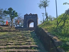
In 1857, the Nguyen court built Tran Duong Fort on the mountaintop to monitor ships from afar and prevent enemies from seizing this strategic height. At the western foothill (Mo Dieu area), General Nguyen Tri Phuong built the Phong Hai Fortress in 1841 — a two-tiered bastion equipped with dozens of cannons aimed at the harbor. In those days, Son Tra was strictly off-limits to strangers; in 1830, when a Frenchman secretly climbed the mountain, Emperor Minh Mang dismissed two coastal guards for negligence — a testament to how seriously Son Tra was guarded as a shield for the imperial capital of Hue from the sea.
Son Tra’s historical depth is also marked by foreign incursions. In the early morning of September 1, 1858, the French–Spanish allied forces fired the first shot of their invasion of Vietnam from the waters below the peninsula. Son Tra thus became one of the first battlefields of the anti-French resistance. Nearly a century later, during the Vietnam War, the Americans built a strategic radar station and military base on the summit — marking it on their maps as “Monkey Mountain.” Traces of wartime remain: on the road to Ban Co Peak, I caught glimpses of weathered concrete platforms, likely once gun emplacements or observation posts.
At the windswept Ban Co Peak, I encountered the statue of De Thich (the Celestial Emperor) sitting in quiet contemplation over a stone chessboard — the living emblem of a famous legend tied to this place. As the story goes, two celestial beings often descended here to play chess atop Son Tra’s summit. The match stretched on for days without a winner. One day, heavenly maidens descended to bathe at the beach below. Distracted by their laughter, one celestial player made a careless move and was checkmated. In anger, he flung the chessboard into the sea before returning to the heavens. The beach where the maidens bathed became known as Tien Sa Beach (“Landing Fairies”), still gracing the peninsula’s northern shore today. Local lore claims the chessboard still rests somewhere in the ocean’s depths. In honor of the tale, Da Nang’s people carved the statue of De Thich playing chess alone at the peak. Every year, thousands of visitors come here to “play” alongside the celestial king and capture photographs, as if stepping into a heavenly realm themselves. Amid the drifting clouds and mountain air, I too posed for a souvenir photo beside the stone chessboard — proof that I had once stood in this ethereal place.
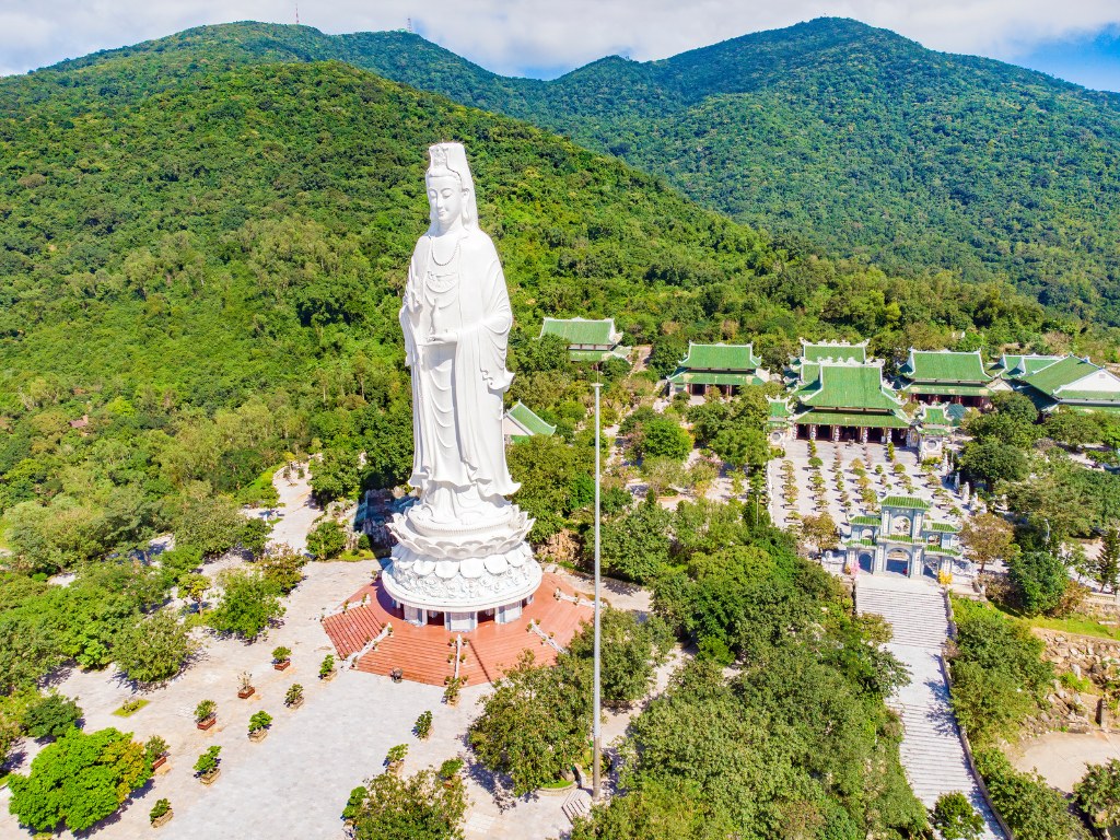
On the southern slope at Bai But lies Linh Ung Pagoda, a relatively new temple that has quickly become a popular pilgrimage and sightseeing spot. Covering 20 hectares, it was begun in 2004 and inaugurated in 2010. Visible from afar, the towering white statue of Avalokitesvara Bodhisattva faces the sea in serene grace. Standing 67 meters tall with a lotus base 35 meters in diameter, it was once recognized as the tallest Buddha statue in Vietnam.
The Nguyen court once regarded Son Tra as a sacred land, with legends of a precious gem on the mountain that glowed at night. They conferred titles to the mountain deity of Trà Son, praying for peace and prosperity. Emperor Tu Duc even issued orders forbidding the exploitation of timber, stone, and charcoal from Son Tra and the nearby Marble Mountains — “to let the land breathe again” — a remarkably early environmental policy for the 19th century.
Indeed, Son Tra holds not only unique natural landscapes but also profound spiritual and cultural value. Every peak, every beach here bears a legend or a historical mark, weaving together the distinctive identity of Da Nang’s “jewel peninsula.”
Preserving Son Tra for the Future
First and foremost, it is about love and a sense of responsibility toward Son Tra. From the Nguyen emperors of old — determined to safeguard these sacred mountains — to the people of Da Nang today, who are willing to sign petitions or take to the streets to defend the peninsula from large-scale projects, all share the same purpose: to keep this “emerald jewel” intact for generations to come.
Equally vital is timely intervention by authorities with a long-term vision. The early establishment of the nature reserve in 1977, followed by continued strengthening of management regulations, has created a legal shield protecting Son Tra from being carved up. Even when promoting tourism, the city has committed to a sustainable path, placing conservation as the top priority.
Science and community involvement also play an indispensable role in preservation. Son Tra has been meticulously studied by scientists, yielding invaluable ecological data — from records in the 1970s noting 985 plant species and 36 mammal species, to recent surveys showing over 2,000 red-shanked douc langurs thriving here. These scientific findings have convinced policymakers of the peninsula’s extraordinary value. Meanwhile, the local community — from residents and photographers to students — has taken action: refusing to hunt, refraining from littering, and volunteering as “forest guardians” to report violations.
To ensure Son Tra remains green forever, we must build on what has been achieved. This means continuing education and awareness programs for younger generations to nurture a love for nature. It means developing responsible eco-tourism — such as small-group douc langur watching or limited camping experiences — allowing visitors to immerse themselves in its wild beauty without harming it. The city could also explore the use of technology in management, for example, installing wildfire surveillance cameras or wildlife monitoring systems.
Connecting Son Tra with nearby reserves — such as Hai Van and Bach Ma to the north — is worth considering, creating continuous green corridors for wildlife movement and enhancing habitat integrity. Most importantly, all development plans must undergo thorough environmental impact assessments, with conservation experts consulted to ensure we “never trade nature for economics” — a principle Emperor Minh Mang upheld nearly two centuries ago.
Phong Nha Việt